Location analysis and data visualisation for your business
Harness location intelligence to give your business an edge, whether that is choosing the location for a new store, plotting franchise areas or analysing customer locations and groupings. Our consultancy service offers a low, fixed-cost alternative to investing in your own commercial mapping software.
Customer profiling and heat mapping
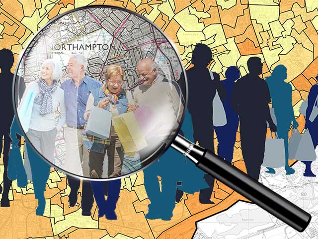
Geodemographic analysis lets you better understand a person, just based on where they live. Turn customer postcodes into insight about their preferences and lifestyle.
- Add depth to your customer database by appending geodemographic customer segments
- Use geodemographic analysis to understand customer life-stage, lifestyle, and likely behaviour
- Heat map customer or demographic group penetration to target campaigns and identify new branch locations
Location analysis and network mapping
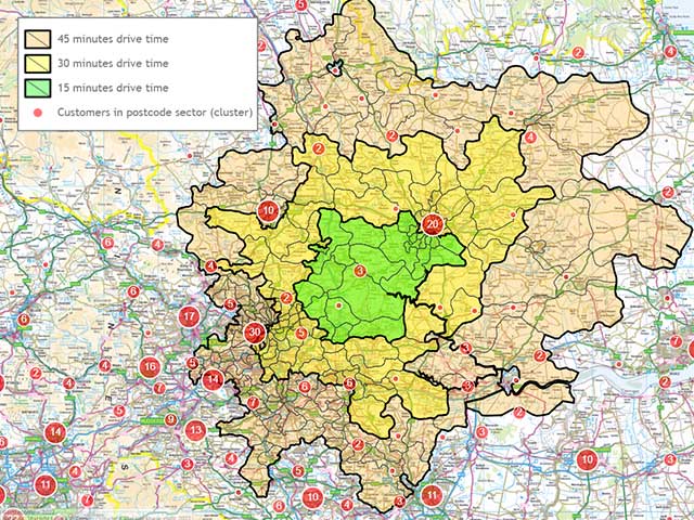
Make your new business, franchise, or network a success using location intelligence to ensure it is competitively located.
- Use travel distance radii and demographic profiling around your location to calculate potential audience size and value
- Plot competitor sites against your own network to identify cross-over, cannibalisation, and areas of opportunity
- Pinpoint local transport hubs, attractions, and facilities that might increase likelihood of customer visits
- Overlay your distribution and delivery network hubs and catchments on to maps to ensure an efficient supply chain and order fulfilment
Sales territory optimisation and call scheduling
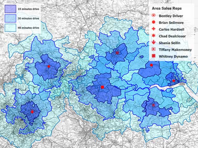
Whether you are about to recruit a new sales team, or review existing sales territories, we have a range of services to make your field team more effective. Turn abstract sales data into visual, usable data maps for your sales force.
- Multi-factor sales territory balancing, based on travel distance or time radii, customer count or value, demographic group hot spots, or existing network boundaries
- Call scheduling based on the latest road network and accurate travel times for efficient client visits
- Bespoke maps for each stakeholder level: from giant-size head-office network maps, to local catchment maps for your field-team, and interactive maps to identify closest agents to new customers
How can we help you?
We are happy to act as an outsourced GIS mapping team or supplement the expertise of your own team.
Why not see what we can do for you.