Mapping Yorkshire
As a Yorkshire-based mapping consultancy we sometimes struggle to divorce ourselves from our surroundings. Geographically, Yorkshire is known for its large size and changeable borders - one version of events has Yorkshire Day stemming from protests about the 1974 changes to the county boundaries. Given the - mostly fiction - animosity with some of the surrounding counties we thought we’d look at the different ways Yorkshire can be mapped - mainly to show how bonkers our regional definitions are.
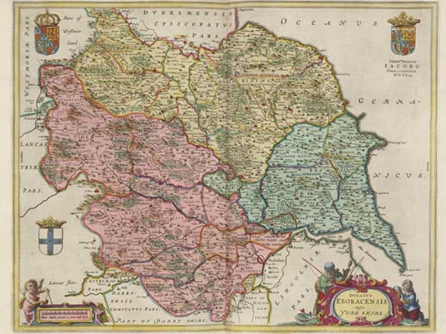
Putting the York and the Shire into Yorkshire
So York predates the shire by a few hundred years. The Vikings started it all by renaming the main town in the area “Jorvik” (previously the Romans had called it Eboracum then the Anglians Eoforwic). The Anglo Saxons then simplified it to York. (Without them, would we live in Eboracumshire or Eoforwicshire?)
Thanks to this Scandinavian influence, there are several distinct geographical terms used when describing the administrative geography of Northern England.
- Wapontake not Hundred: The 10th century division of the “Hundred” to create smaller manageable government and taxation areas were known as “Wapontakes” around York, Lincoln, Leicester, Nottingham, Derby, and Rutland thanks to the Danish term for “the taking of weapons”.
- Shire not County: The next largest administrative area in Anglo-Saxon England was administered by a Sheriff leading to the term Shire. Following the Norman conquest they coined the term “County” by placing these larger administrative areas under the control of a count. A few counties held on to the Shires in their name, including Yorkshire.
- The Ridings: This term is a sub-division of a county and is again a loan word from Old Norse meaning “a third''. They were created to ease the administrative burden of a large county. This term causes some confusion to a modern day audience who expect an area for each of the four main compass points. Indeed, there have been East, South, West and North Ridings but the South version was only in a novel.
This trend of aggregation and inheritance from previous administrative systems and their boundaries is the root of why Yorkshire is so difficult to rationally and conclusively map. Taken to an extreme, if we just look at shared etymology, a case could be made that a map of Yorkshire should incorporate Lincolnshire, Nottinghamshire, Northumberland, and Cumbria.
Mapping Yorkshire’s present day boundaries
Administrative geography has grown in complexity as the nation and its population has developed (see our administrative geography blog for more on this). Since boundaries have changed so much, if someone wanted to map Yorkshire a key question would be “when?” The simple answer of “today” isn’t as clear as you would hope thanks to the contentious administrative changes of the early 1970s.
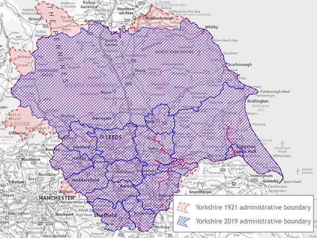
The Local Government Act of 1972 proposed a new boundary for the county and, when it was applied in 1974 caused some contention. These seemingly arbitrary changes caused the county to shrink in some areas yet grow in others, most notably in its borders with Lincolnshire and Lancashire. Thanks to the uproar at the time, this event has created an idealised snapshot of what Yorkshire is, that doesn’t necessarily match official present-day administrative boundaries.
These boundaries continued to change organically for the past 50 years, leading to a somewhat less contentious and slightly reduced county size when we compare 2019 administrative boundaries with those of 1921.
Addressing post to Yorkshire
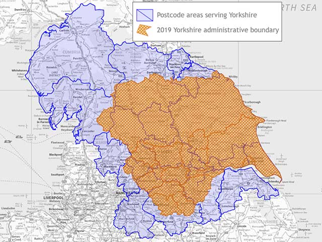
Local geography tends to become most relevant to people when they are waiting for a delivery or programming their satnav, but though most people know their own postcode, they don’t know how postcode geography works. Postcode geography evolved separately and later than the geography of government (see our postcode blog for more on this). As a result, the UK postcode map bears only a passing resemblance to an administrative map of the UK.
Postcode areas tend to be named after an area’s major or “post town”, so the area around York has the postcode area of YO. But, as well as originating separately, the postcode geography of England has also evolved organically in response to population and industry growth. As such, when addressing post to delivery points in Yorkshire you have what you expect with York (YO), Leeds (LS), Harrogate (HG) and the like. You also have Yorkshire residents with postcode prefixes for Carlisle (CA), Lancaster (LA), Stockport (SK) and Teesside (TS).
Is there a definitive map of Yorkshire?
The short answer is that there is no definitive map of Yorkshire. Boundaries vary depending on the purpose you are mapping for, when you are mapping it, and even who is asking. This may well be why, if you ask any dyed in the wool Yorkshire-person “where is Yorkshire?”, they will tap on their chest above their heart and say “here”. Anything more specific than that is less poetic and far more subjective.