Mapping and working with healthcare geography
As mapping consultants, we are always keen to point out that effective service depends on good geographical analysis and planning. However, nowhere is this more important than in the field of healthcare provision. Location intelligence can make a vital difference to effective healthcare provision, whether you are:
- evaluating a community’s healthcare need
- optimising patient transport routes and hubs
- siting a clinic in the best spot to service a community
To explore this, we take a look at the factors unique to mapping and analysing the UK’s healthcare geography.
Changing boundaries and healthcare authority names
Existing healthcare authority boundaries are an important variable to consider in any form of geographical analysis. The boundaries themselves were imposed in an attempt to provide meaningful and efficient healthcare funding and provision catchments. As with all top-down, imposed geographies, boundaries can seem very arbitrary, and are subject to regular change.
The trend in healthcare geography seems to be that the larger geographical units and names undergo major change every 10 years or so:
- In 2001, Primary Care Trusts (PCTs) were introduced. They replaced “GP funding” and started a trend towards consolidation of healthcare units. In 2006, these macro units were further reduced from 303 PCTs down to 152.
- In 2013 Clinical Commissioning Groups (CCGs) replaced PCTs. At their founding, they were quite numerous with more than 200 CCGs covering the country but by the time their replacement was announced, these had been consolidated into 106.
- 2022 is due to see the implementation of Integrated Care Systems (ICS). This brings further consolidation and the new regime is due to start with just 42 ICS.
It is important to emphasise that each major change didn’t set a fixed map of healthcare boundaries for the entire period. Both PCTs and CCGs were consolidated and changed throughout their existence so we should expect similar flux from the ICS.
Regional variation in healthcare provision
To add to the fluidity of healthcare geography, the pattern in England is not always duplicated across the United Kingdom. Taking CCGs as an example - since ICS are still not fully established:
- Scotland has 14 Regional Health Boards with a role broadly comparable to a CCG
- Wales has 7 Local Health Boards (LHBs) which are again comparable to a CCG
- Northern Ireland is covered by a single Health and Social Care Board (HSCB) with a broader remit than a CCG, straying into the social services typically provided by local authorities
Changing roles and blurring healthcare boundaries
PCTs were formed to allow units to set their own healthcare budgets and priorities. Similarly, CCGs were a group of health practitioners who came together in an area to commission the hospital and community NHS services they felt best served that area.
The new ICS, have a new drive to improve overall population health and tackle larger-scale health inequalities. This will involve a more collaborative approach with local authorities to try and influence social and economic factors affecting a community’s health.
By straying into areas formerly undertaken by local authorities - such as social care - any kind of geographic analysis will now need to consider other administrative geographies.
Case Study: Identifying the socially isolated
How Northamptonshire County Council use our geodemographic data to identify those most in need of social prescribing services.

Working with healthcare boundaries
Geographically, CCGs sit in the broad category of “Administrative Geography” - as opposed to postcode geography which is widely used in the private sector. CCGs are quite large and so, in terms of size most comparable to postcode areas (for example YO), if slightly larger (around 106 CCGs vs 90 postcode areas cover England).
Although the fundamental health geographical units are large, they are intended to service real people who are bound by the realities of locality, travel infrastructure, and journey times. So for most practical projects these larger, abstract units need to be broken down into meaningful subsets. As such, it is often necessary to overlay other geographies on to CCGs in order to undertake any meaningful analysis. For example contractors and private ambulance providers often work across CCG boundaries making postcode and road network data vital in any geographical analysis. To make matters more challenging, the boundaries of these different networks rarely match.
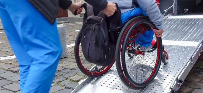
Case Study: Choosing clinic location by travel time
An NHS Healthcare Trust asked us to help them to intelligently plan the location of their outpatient clinics based upon travel times.

As we’ve seen, the healthcare landscape changes regularly, so always ensure that you are working with the latest data. The Office for National Statistics provide us with the latest health authority boundaries. They update and release the data following any changes to the network and we post it to both our Prospex GIS and MapVision online mapping tool.
The first cut of the ICS network has yet to be released at time of writing, but as soon as it is, we’ll post it to our MapVision system, so you can see how the latest healthcare boundary network looks.
We've spent more than 25 years visualising complex data and making it easy to understand.
If you'd like to see if we can help you please get in touch.
online or call us on:
Our other blogs
Mapping and working with healthcare geography
Location intelligence can make a vital difference to any kind of service provision. Nowhere is this more important than in the field of healthcare. We look at the factors unique to mapping and analysing the UK’s healthcare geography.
British Population Survey (BPS)
The British Population Survey (BPS) is a survey of household income and shopping habits collected by face-to-face interviews. We take a look at the BPS in detail, what exactly it is made from and how its data can be usefully applied by businesses and public organisations.
What is geodemographic profiling?
More than 64 million people live in the UK, each with their own outlook, priorities, needs and way of life. Geodemographic profiling offers a way to group these individuals to try and identify the right audience for your product or service.
The census helps you to understand your customers
The UK Census 2021: what it is, how is it made, and how can it be used to help your organisation with demographic analysis.
Using geographic intelligence to grow the UK’s broadband network
Using geographic intelligence to sustainably grow the UK’s broadband network.
Mapping efficient sales territories
We've worked with mapping, demographic, and travel data for a long time, and have become specialists in territory mapping. So we'd like to share a few tips on how best to define sales catchments for your team, or embark on territory review.
TimeTravel: the latest update
We look at the latest update to TimeTravel, our dataset of drive times and distances between any postcode sector or district. What has changed in the UK road and geographic network, plus new features to make it even more accurate.
How to create a postcode map
Turning a list or spreadsheet of postcode data into a series of points on a map isn't as simple as using an Excel wizard to do it for you, but it isn't rocket science. We look at the best way to create a postcode point/pin map.
Living Costs and Food Survey
The Living Costs and Food survey (LCF) is compiled every year and is used by the UK and European governments, Department for Transport (DfT), and Her Majesty’s Revenue and the Customs (HMRC). But what is it, and why should we care?
Cycle to work day
Each year for #cycletoworkday we take a look at cycling statistics across the country and try to map that data and find interesting trends. This is mainly because we at Beacon Dodsworth are either a little bit obsessed about cycling, or we tend to worry about the environment.
Mapping for local projects
Recently, we were contacted by a company responsible for organising charity door knockers. They needed more than 9,000 postcode sectors mapped at A4 size to use at a local level to plan fundraising routes and clearly define territories for each agent.
Social change over 10 years
With the next census due to take place this year, we thought it was a good time to take stock of some of the changes and trends we noticed between the 2001 and the 2011 census. What difference does 10 years make to our society and the people that live within it?
Beacon Dodsworth New Office
Now we are back in the office, we continue to support hybrid working. So, we’ve taken the opportunity to downsize our office to make us more resilient to future lockdowns, staff self-isolation, and any other uncertainty the modern world might throw our way.
Postcode to postcode drive time and distance
What happens if we want a postcode to postcode drive time lookup table?
Administrative Geography
Administrative geography is a way of dividing the country into smaller sub-divisions or areas that correspond with the area of responsibility of local authorities and government bodies. We take a look at administrative geography, what it is and how to use it.
Who spends most on Fruit and Veg
National Vegetarian Week (#NationalVegetarianWeek) this year ran from 10th to 16th May. It gave us the opportunity to highlight how GIS mapping can be used to create marketing campaigns and raise awareness of the benefits of eating more fruit and veg.
Data visualisation and colour blindness
John, our director talks about living and working with colour blindness in the mapping industry where colours are pivotal in adding dimensions to people's understanding.
How far is it to the beach
We use Beacon Dodsworth's scripting technology to answer that most important of questions when the sun finally does threaten an appearance.
All you need to know about postcodes but were afraid to ask
The humble postcode has been around for years. We look at how postcodes are used and what led to their introduction.
Yorkshire Day
As a Yorkshire-based company, we wanted to help celebrate Yorkshire Day, which takes place on 1st August. Naturally, we wanted to put a geographic spin on the celebration, so we took a look at drinking preferences within God’s own county.
The foundations of geographical analysis
Displaying data on maps makes it easier to understand as well as giving a new perspective on a problem. Using a GIS to prepare and present data has become increasingly popular over the last 20 years, but graphical displays of data on maps were around long before computers came along.
How to back up your Prospex data
Keep your GIS projects safe by using the in-built Prospex back up process. Here is how.
The power of postcode sectors
Postcode sectors are aggregations of individual postcodes and they provide meaningful geographical reporting areas in any GIS. However, they aren't as easy to map as you might think. Here is how we do it.
Where is the North
We've used the territory manager tool in Prospex GIS to split the UK into north, south and east and west with equal population counts.
What is GIS software?
A Geographical Information System (GIS), is a tool for analysing, visualising, managing and presenting data that is related to a physical, geographical location. That link to geography is the key difference between GIS and other data visualisation techniques.
Mapping GP prescription data
An article by Allan Brimicombe (Head of Centre for Geo-Information Studies at the University of East London) & Pat Mungroo on using GP prescription data to understand health needs.
Geodemographics and the University of East London
The University of East London explain how they have been using our P² People & Places geodemographic classification.
Google Fusion Tables
After almost 10 years of service, Google retired their Fusion Tables product at the end of 2019. This tool was very useful at visualising and sharing large amounts of tabular data - particularly amongst small and mid-sized businesses. So what can we do to fill the gap left by this tool?
Call 01904 701020, complete Contact Form or Sign Up
 Sign up for our newsletter
Use of cookies
The Beacon Dodsworth site uses cookies to improve your user experience and to provide analysis of how our site is used.
Your continued use of this site is taken as implied consent to receive cookies from us and our analytics partners.