Welcome to the Beacon Dodsworth blog
The aim of our blog is to inform, educate and entertain, all with a geographic or demographic twist. We believe that location intelligence enhances processes, improves planning capability, and ultimately enables people to work smarter in every sector and industry.
Our blog contains practical examples of using GIS, mapping, software and data solutions in business. It's updated by different members of our team, so you can expect a different perspective on a wide range of subjects.
Using GIS to visualise wildlife changes
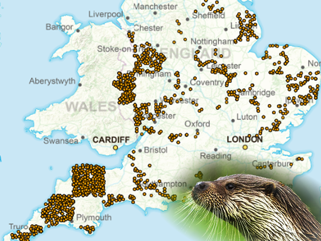
World GIS day is a celebration of the use and users of GIS. This blog covers how GIS can be used to help conservation and the natural world.
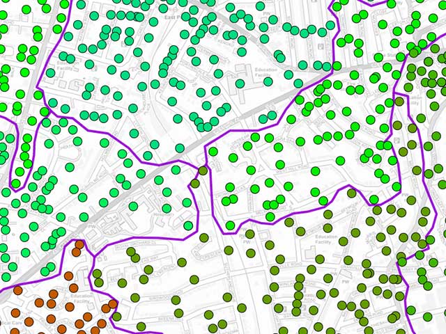
Data visualisation and colour blindness
John Dodsworth is a director of Beacon Dodsworth and has worked with geographical information systems since the early 1990s. Those of us who work with him know that he is colour blind, a fact that those who have used the GIS systems and maps he has created might be surprised to hear. With the current prevalence of infographics and data maps daubed in red and green, John wanted to write about his experience of colour blindness in a world of colourful data, charts and maps.
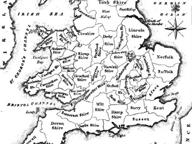
Mapping Yorkshire
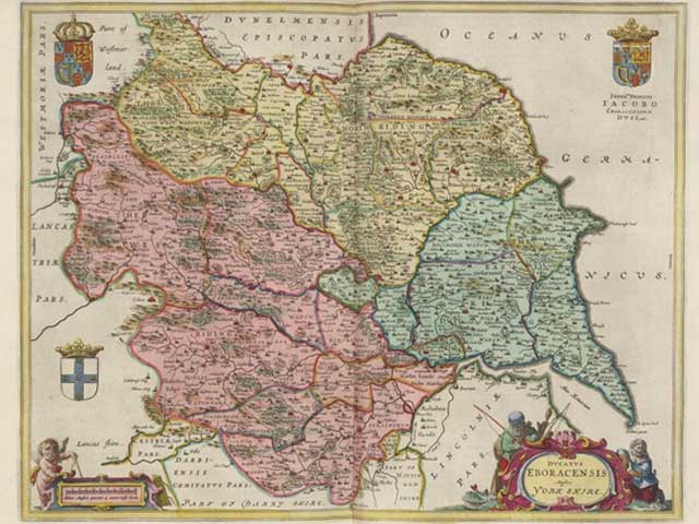
Geographically, the county of Yorkshire is known for its large size and changeable borders. As a Yorkshire-based mapping consultancy we thought we’d look at the different ways the county can be mapped - mainly to show how bonkers our regional definitions and borders are.
Rationalising or downsizing your network
In an ever-changing marketplace, a business needs to evolve to stay competitive. With costs spiralling, this is more important than ever, and every store in your network needs to be optimally sited to be sustainable. We look at how location data helps you assess your store locations and potential to create a more sustainable network in the most profitable locations.
Mapping and location analysis for the tourism sector

Mapping for the tourism sector has several features that set it apart from commercial business mapping. We’ve worked with our fair share of clients, from hotel chains to country houses, so wanted to give you a few things to consider if you are trying to apply location intelligence to your venue or attraction.
Where can I find more customers and more profitable customers?

Customer mapping and geodemographic profiling helps businesses of every size to locate and target new customers and the most profitable audiences. We look at how you can get started with this valuable exercise, often referred to as "location intelligence", to make your business more sustainable.
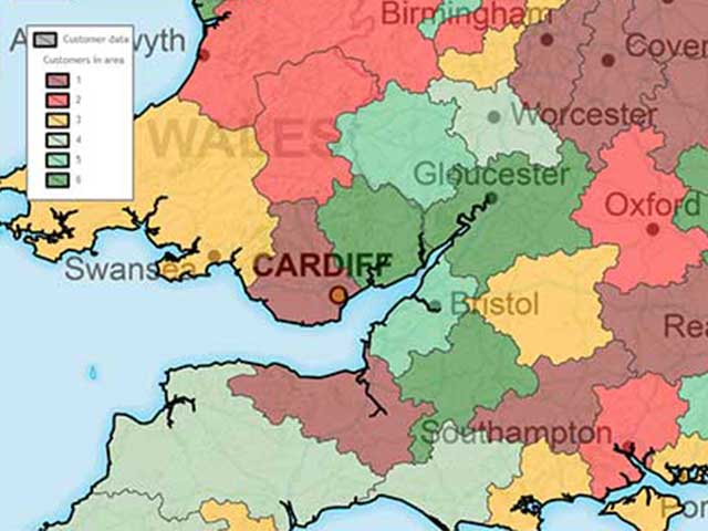
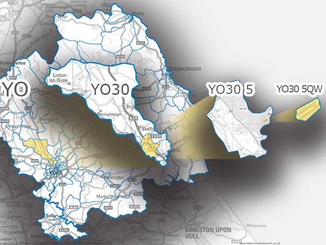
The power of postcode sectors
A postcode sector is an aggregation of individual postcodes. It is represented by the first half of a postcode and the first number of the second half. We look at how these areas are defined, how to map them, and why their size makes them the perfect reporting unit for geographic or geodemographic analysis, and a vital building block for GIS or mapping systems.
What is administrative geography?
Administrative geography is one of the fundamental building blocks for government and local service provision, yet few people understand it. We look at what it is, how it came about, how it differs from postcode geography, and how to work with it.
All you need to know about postcodes
We all (should) use postcodes. That handy series of letters and numbers coupled with a building name or number is all that is needed to get deliveries to our door. Unlike many other postcode systems, U.K. postcodes are easy to decode and geographically descriptive. Since their widespread introduction almost 50 years ago, postcodes have been used to get deliveries to the correct address, describe areas and localities, and as an effective way to geocode and map other data.
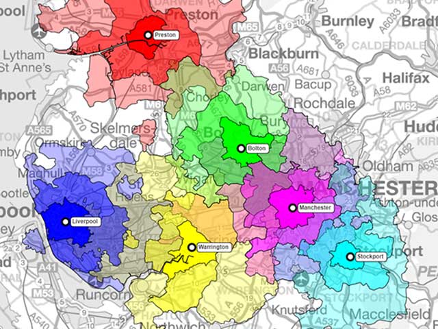
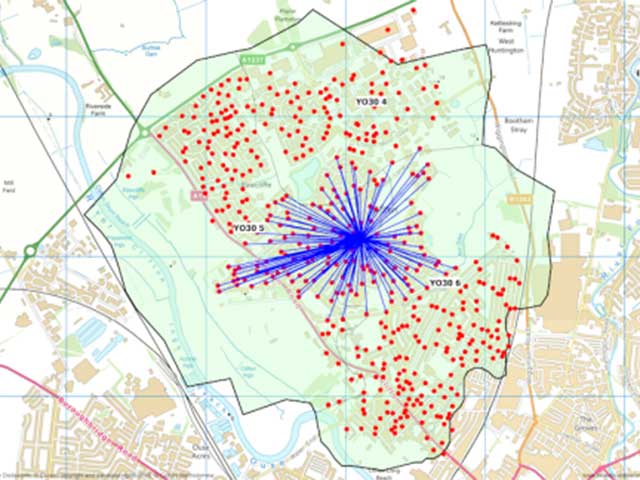
Mapping efficient sales territories
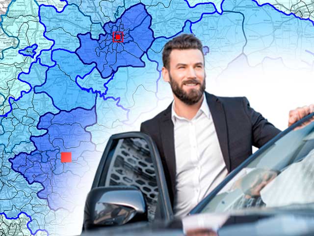
Whether you are in the fortunate position of expanding your sales team to meet demand, making your existing sales catchments more efficient or identifying hunting grounds for a new business; territory planning needs some serious consideration. After all, a small team with efficiently planned sales catchments is more effective than a larger team that spends all of their time on the road travelling to smaller or less valuable clients - and with a far higher profit margin!
From spreadsheet to map: how to create your first postcode point map
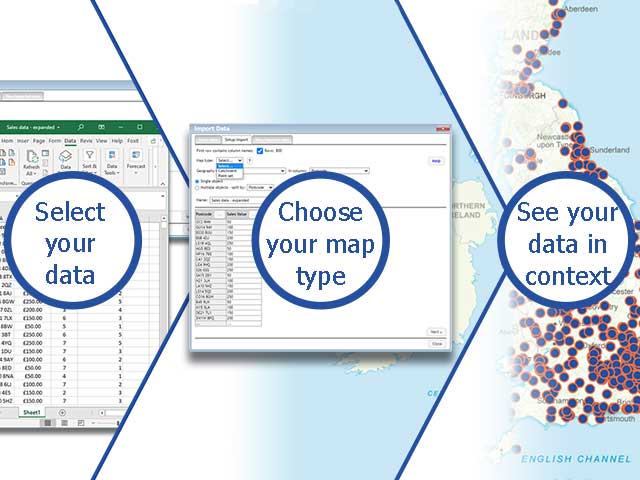
So you have a spreadsheet full of postcodes that you’d like to turn into a visual data map. We’ve spent 30 years mapping data and creating mapping tools, so we like to think we know a little about postcode maps.
Can I have a postcode to postcode drive time and distance lookup table?
With online mapping data increasingly accessible to the public, journey planning seems easier than ever. However, once you move beyond individual journeys to look at onward travel, planning for a fleet of vehicles, or a network of locations, things quickly get complicated. One question new clients often put to us is “Can we have a simple table of travel times between each postcode?” Unfortunately, this seemingly simple question comes with some significant challenges...
How can we help you?
We are happy to act as an outsourced GIS mapping team or supplement the expertise of your own team with our consultancy services.
Why not see what we can do for you.